Greetings from the Smith-Donovan trailer park in Lewes, Delaware. We are in the middle of a little road trip to see Molly, do some birding and photography, and do a couple more stops on our Lewis and Clark tour. And there’s always some work to be done on the trailer. That’s a given.
We did a two-day trip here so we could hit a couple more Lewis and Clark spots. This time it was Harpers Ferry, West Virginia, and Pittsburgh, Pennsylvania. Arriving just hours after hurricane Ida dumped massive amounts of rain on the area.
When last we left our intrepid explorer, Meriwether Lewis had gone to Philadelphia and Lancaster, Pennsylvania, to meet with various experts in fields of study required for the expedition. And to purchase supplies. Lots of supplies. But the Philly and Lancaster trip came in between two trips to Harpers Ferry.
The reason for the Harpers Ferry visits was the U.S. armory located there. At the armory Lewis acquired the expedition’s arms as well as spare parts and ammunition for those arms. In addition to arms acquisition, he worked with the armory craftsmen to build a collapsible canoe of his own design. The canoe had an iron frame that could be covered with hides and the hides sealed with tar and pitch. The canoe worked well when tested at the armory but unfortunately, failed when they needed it later during the expedition. Sort of like a new cell phone. Everything works fine at the Verizon store, forget it when you get home.
Harpers Ferry is located at the confluence of the Shenandoah and Potomac Rivers and is loaded with history. Jefferson passed through the area in 1783 and extolled about the view from the now named Jefferson Rock. George Washington came to Harpers Ferry in 1785 and in 1794 proposed it as the site of a federal arsenal. Given its strategic location, Harpers Ferry became a manufacturing and a transportation hub.

The confluence of the Shenandoah with the Potomac looking east from Harpers Ferry. The Potomac comes in from the left and continues eastward. The Shenandoah joins in from the right.

Jefferson Rock. From my 2019 thru hike.

The view from Jefferson Rock. From my 2019 thru hike.
Harpers Ferry is probably best known as the site of John Brown’s failed attempt to start a slave uprising prior to the Civil War. Brown’s idea was to take over the armory and distribute the arms to the slaves. The attempt failed and was put down by then U.S. Army Lieutenant Colonel Robert E. Lee, and his aide-de-camp Lieutenant J.E.B. Stuart.
Because of its strategic location, Harpers Ferry changed hands eight times during the Civil War. Needless to say, the town and armory were essentially blasted to pieces during the course of the war. The buildings in the lower town have all been rebuilt since the Civil War. Against the wishes of the white population, in 1868, Storer College was founded to educate freed slaves. The town also became a center of black tourism. In 1906, the Niagara Movement, which led to the formation of the NAACP, held a conference led by W.E.B. DuBois at the college. In 1944, FDR signed a bill making the lower portion of Harpers Ferry a national monument.

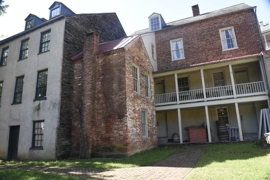

Lower town buildings.
I have a special fondness for Harpers Ferry. The Appalachian Trail goes through Harpers Ferry. It’s home to the Appalachian Trail Conservancy and was historically close to the midpoint of the AT. The current midpoint is a hundred or so miles further north in Pennsylvania. During my 2019 AT thru hike, I took a zero (or rest day) in Harpers Ferry. Leaving it, I did my longest trail day, going 26.4 miles. A marathon in AT lingo. Some people, that apparently have no reason to live, try the AT four-state challenge. You start at the Virginia/West Virginia border, blow through the couple miles in West Virginia and Harpers Ferry, hustle through the relatively flat 40 miles of Maryland, and cross the Mason-Dixon line into Pennsylvania at Penn-Mar. The goal is to do the 43.5 miles in 24 hours or less. Hallucinations after 20 hours are optional. I had zero interest in attempting the four-state challenge.
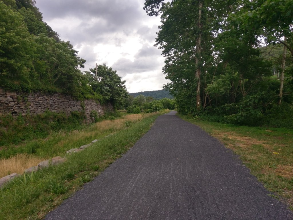
The Appalachian trail, here part of a rail-trail, leaving Harpers Ferry. From my 2019 thru hike.
After Harpers Ferry, Lewis went to Fort Fayette (A.K.A. Fort Lafayette) in Pittsburgh. One could argue that Pittsburgh is the true starting point for the Corps of Discovery.
Lewis had all his supplies from Philadelphia and Harpers Ferry shipped to Fort Fayette at Pittsburgh. It was in Pittsburgh during the Whiskey Rebellion that federal militiaman Meriwether Lewis first met federal regular soldier William Clark, and in Pittsburgh Lewis received the letter from William Clark confirming that Clark would join the expedition. Pittsburgh is where Lewis purchased his Newfoundland dog named Seaman for the then exorbinant price of $20. This is where the expedition keel boat was built and launched with the first eleven members of the expedition; seven soldiers recruited from the Carlisle, Pennsylvania army barracks, a river pilot, and three young men “auditioning” for the expedition. One of those young men was John Colter who would later go on to explore the Yellowstone area after the Corps of Discover expedition.
On August 31, 1803, Lewis and the crew started the Corps of Discovery expedition by launching the loaded keel boat and floating three miles down the Ohio River to Brunot Island. On Brunot Island Clark showed a friend his pneumatic air rifle. Not knowing how the air rifle worked, his friend accidentally fired off a round, grazing the skull of a female bystander. A couple hundredths of an inch could have made the expedition’s start a disaster.
Approximate launching point for the Corps of Discovery on the Allegheny River.
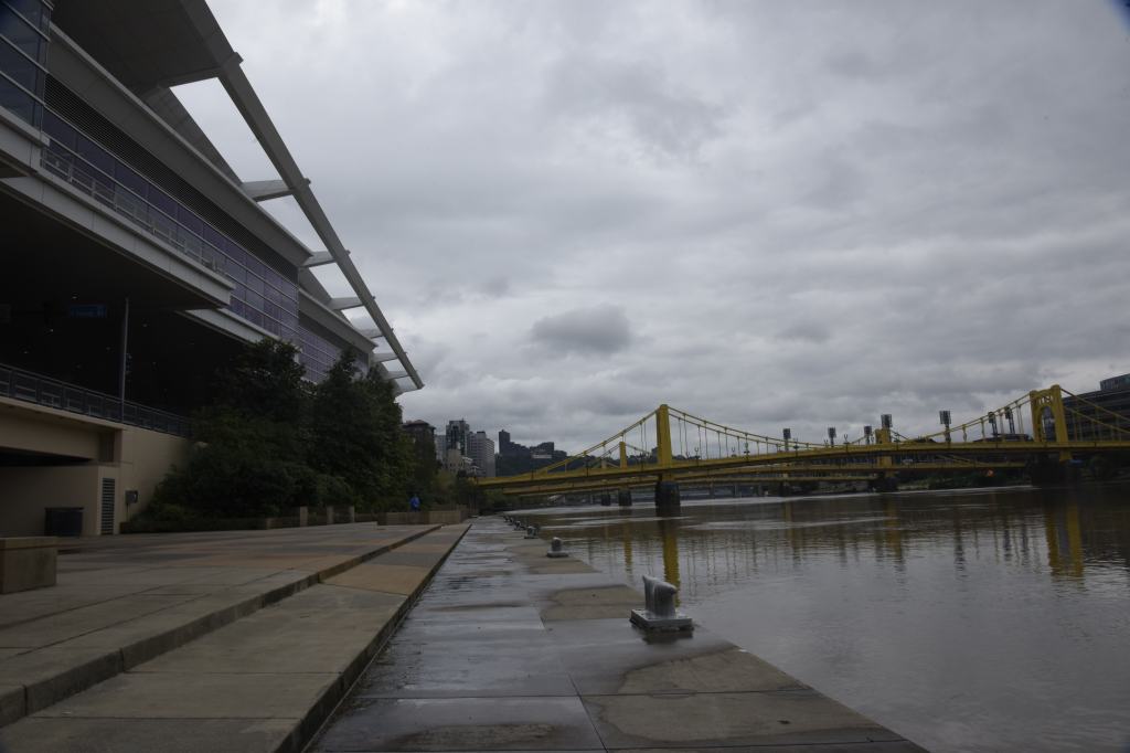
Pittsburgh is located where the confluence of the Allegheny and Monongahela Rivers form the Ohio River. Isn’t Monongahela a cool word to say? Just kind of rolls off the tongue.

Allegheny River.

Monongahela River.

Looking down the Ohio River at its very start at the confluence of the Allegheny and Monongahela Rivers.
In early America, rivers were the interstate highway system, making this confluence one of the more strategically important spots in North America. Especially if you’re seriously interested in westward expansion from the Northeast. Originally occupied by the Iroquois, Shawnee, and Lenape, the first Europeans to pass through the area were Frenchmen Robert de La Salle and Martin Chartier in 1669. For the indigenous people, everything was downhill from there. From that time on, various combinations of American Indians, the French, the British, and the Americans all fought each other for control of the area. Various forts were built, laid siege to, destroyed, rebuilt, and destroyed again. The Colony of Virginia and the Province of Pennsylvania both claimed control of the confluence through their royal charters until a 1780 federal agreement extended the Mason-Dixon line and gave the area to Pennsylvania.

Outline of Fort Pitt.

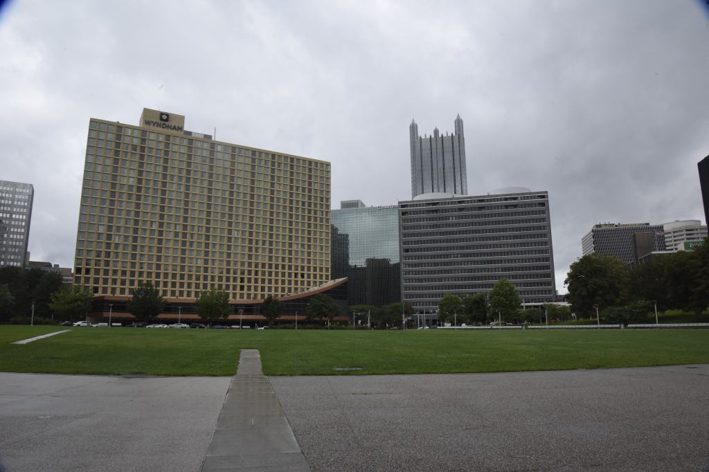
After the Revolutionary War, Pittsburgh became the jumping off point for travel west. By the time Lewis got to Pittsburgh to start the expedition, Pittsburgh was an established city with a boat building industry to help the western expansion. Other industries followed including glass manufacture, coal mining, and of course iron production which later became steel production. The steel foundries gave Pittsburgh the nickname, “hell with the lid off”. At one time Pittsburgh arguably had the worst air of any city in the U.S. Economic changes, foreign competition, the clean air act, new technologies, and changes in attitudes led to the demise of the steel industry as it was once known. Like many eastern cities, Pittsburgh has had a renaissance and is now considered a great place to live. With over 300,000 residents within the city limits and over 2.3 million in the metropolitan area it has to be doing something right.
From Fort Pitt at the confluence looking into Pittsburgh.
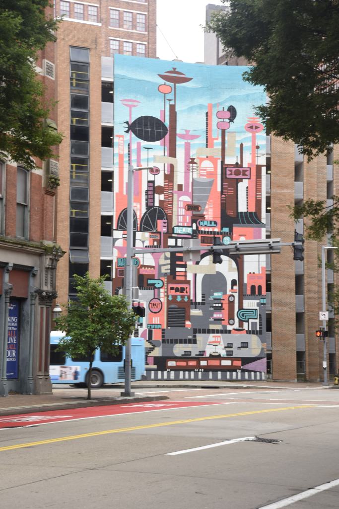
Mural in Pittsburgh.
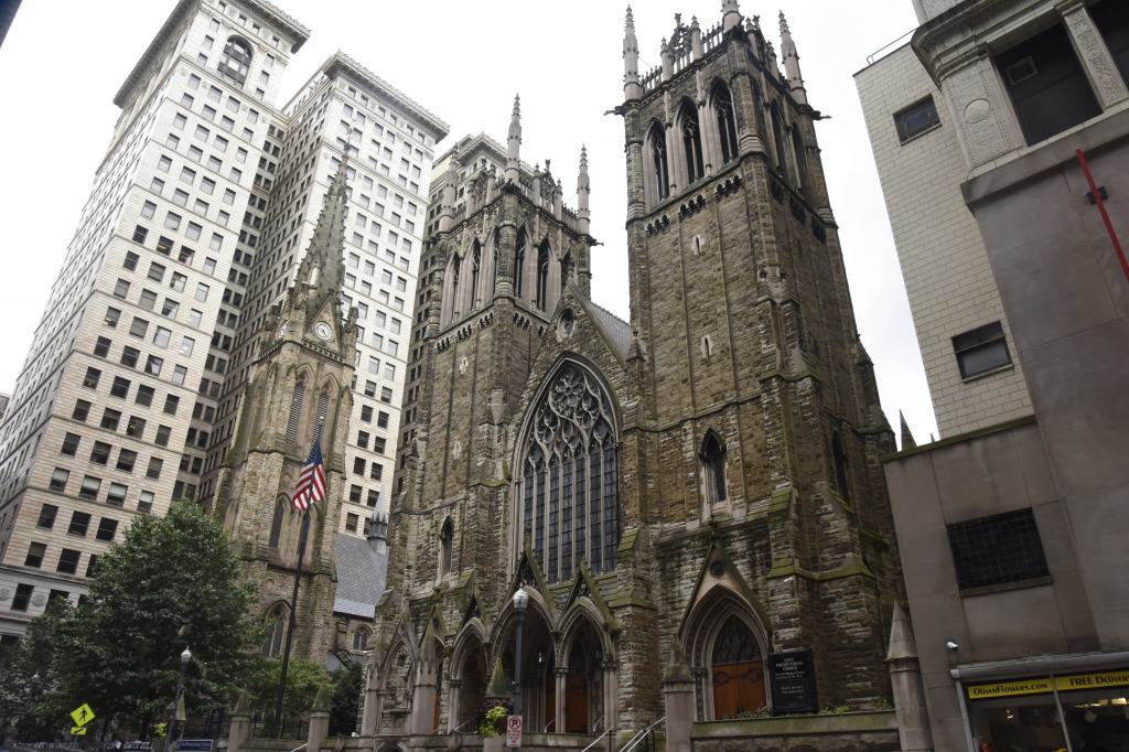
The old and the new.

Pittsburgh Skyscraper.

Heinz Field, home of the Pittsburgh Steelers. Located at the confluence.
